
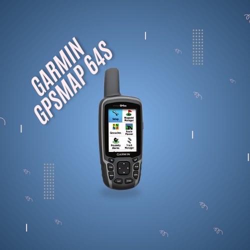

AMANKOM Security Systems offers Garmin GPSMAP 64s with a 2.6-inch color sunlight readable display, high-sensitivity GPS device and GLONASS receiver with a super receiver four-snail antenna. The GPSMAP 64s system includes a 3-axis electronic compass with a barometric altimeter, wireless connection and a year’s subscription to satellite images.

Garmin GPSMAP 64s has a 3-axis compact electronic compass equivalent to tilt, which shows your direction even when you’re standing still, without installing it at the same level. The barometric altimeter tracks changes in pressure to determine your exact height, and you can even use it to draw atmospheric pressure over time, which can help you monitor changing weather conditions.
Wireless Participation
Share road points, paths, trails and geohash wirelessly with other compatible devices. Your friends can enjoy your favorite hiking or cache without waiting to connect you to the computer – simply press “Send” to transfer your information to another hand-held Garmin.
Garmin GPSMAP 64s also connects to Garmin compatible devices, including VIRB motion camera, accessory sensors, and heart rate monitoring.
stay connected
Using smart notifications, you can receive email, text and alerts wirelessly from compatible iPhone® 4s or newer version. Stay connected without having to search your backpack for your smartphone.
Explore the terrain
Garmin GPSMAP 64s comes with a worldwide built-in base map with shaded relief as well as BirdsEye Satellite Imagery one year subscription, so you can navigate anywhere easily. Using image navigation, you can download geo-tagged images from the Internet and move to them.
I have your way when you need it most.
Keep your fix
Thanks to the quad spiral antenna, high sensitivity, GPS, GLONASS and receiver, GPSMAP 64s quickly and accurately locates and maintains its position even in heavy cover and deep valleys. The advantage is clear – whether you’re in deep forests or near high-rise buildings and trees, you can rely on GPSMAP 64s to help you find
Add maps
GPSMAP 64s comes with a built-in foundation map worldwide with a shaded engraving and a year-long subscription to BirdsEye Satellite Imagery for a realistic photo view. Adding more maps is easy with our collection of topographical, marine and detailed road maps. With 4GB internal memory and microSD TM card slot, you can download TOPO 24K and 100K maps easily and go, and connect your pre-loaded BlueChart® g2 cards to a great day on water or City Navigator ® NT map data for the cycle – step-by-step guide to see the maps). Additionally, version 64 is compatible with custom Garmin maps, a map format that allows you to easily convert paper and electronic maps into downloadable maps for your device for free.
Find Fun
GPSMAP 64s non-paper geocaching with 250,000 pre-loaded cache with hints and descriptions of Geocaching.com, supports up to 16 hours battery life. By not using paper, you not only help the environment, but also improve efficiency. GPSMAP 64s stores and displays basic information, including location, terrain, difficulty, hints and descriptions, which means that there is no longer a hand insertion of coordinates and paper prints! Slim and lightweight, 64 seconds is the perfect companion for all your outdoor endeavors.

Basecamp displays topographic map data in 2-D or 3-D on a computer screen, including contouring lines and height profiles. It can also transfer an unlimited amount of satellite images to your device when paired with a Birdseye Satellite Imagery subscription
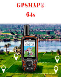
Garmin GPSMAP System 64s
Plan your next trip
Take charge of your next adventure using BaseCamp TM, a software that allows you to view and organize maps, road points, trails and trails. This free itinerary allows you to create Garmin adventures that you can share with friends, family or fellow explorers.
AMANKOM Security Systems offers Garmin GPSMAP 64s with a 2.6-inch color sunlight readable display, high-sensitivity GPS device and GLONASS receiver with a super receiver four-snail antenna. The GPSMAP 64s system includes a 3-axis electronic compass with a barometric altimeter, wireless connection and a year’s subscription to satellite images.
Garmin GPSMAP 64s has a 3-axis compact electronic compass equivalent to tilt, which shows your direction even when you’re standing still, without installing it at the same level. The barometric altimeter tracks changes in pressure to determine your exact height, and you can even use it to draw atmospheric pressure over time, which can help you monitor changing weather conditions.
Wireless Participation
Share road points, paths, trails and geohash wirelessly with other compatible devices. Your friends can enjoy your favorite hiking or cache without waiting to connect you to the computer – simply press “Send” to transfer your information to another hand-held Garmin.
Garmin GPSMAP 64s also connects to Garmin compatible devices, including VIRB motion camera, accessory sensors, and heart rate monitoring.
stay connected
Using smart notifications, you can receive email, text and alerts wirelessly from compatible iPhone® 4s or newer version. Stay connected without having to search your backpack for your smartphone.
Explore the terrain
Garmin GPSMAP 64s comes with a worldwide built-in base map with shaded relief as well as BirdsEye Satellite Imagery one year subscription, so you can navigate anywhere easily. Using image navigation, you can download geo-tagged images from the Internet and move to them.
I have your way when you need it most.
Keep your fix
Thanks to the quad spiral antenna, high sensitivity, GPS, GLONASS and receiver, GPSMAP 64s quickly and accurately locates and maintains its position even in heavy cover and deep valleys. The advantage is clear – whether you’re in deep forests or near high-rise buildings and trees, you can rely on GPSMAP 64s to help you find
Add maps
GPSMAP 64s comes with a built-in foundation map worldwide with a shaded engraving and a year-long subscription to BirdsEye Satellite Imagery for a realistic photo view. Adding more maps is easy with our collection of topographical, marine and detailed road maps. With 4GB internal memory and microSD TM card slot, you can download TOPO 24K and 100K maps easily and go, and connect your pre-loaded BlueChart® g2 cards to a great day on water or City Navigator ® NT map data for the cycle – step-by-step guide to see the maps). Additionally, version 64 is compatible with custom Garmin maps, a map format that allows you to easily convert paper and electronic maps into downloadable maps for your device for free.
Find Fun
GPSMAP 64s non-paper geocaching with 250,000 pre-loaded cache with hints and descriptions of Geocaching.com, supports up to 16 hours battery life. By not using paper, you not only help the environment, but also improve efficiency. GPSMAP 64s stores and displays basic information, including location, terrain, difficulty, hints and descriptions, which means that there is no longer a hand insertion of coordinates and paper prints! Slim and lightweight, 64 seconds is the perfect companion for all your outdoor endeavors.
Basecamp displays topographic map data in 2-D or 3-D on a computer screen, including contouring lines and height profiles. It can also transfer an unlimited amount of satellite images to your device when paired with a Birdseye Satellite Imagery subscription
Garmin GPSMAP System 64s
Plan your next trip
Take charge of your next adventure using BaseCamp TM, a software that allows you to view and organize maps, road points, trails and trails. This free itinerary allows you to create Garmin adventures that you can share with friends, family or fellow explorers.